
Rediscover Forgotten Ballparks Through My Blog
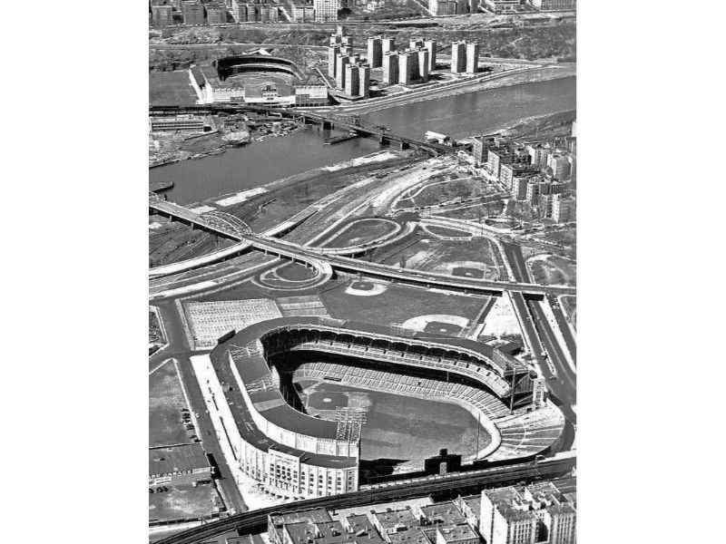
Yankee Stadium and the Polo Grounds – Sightseeing on the Circle Line
By Byron Bennett |
For just over four decades, from 1923 to 1964, two of Major League Baseball’s most ...
Read More 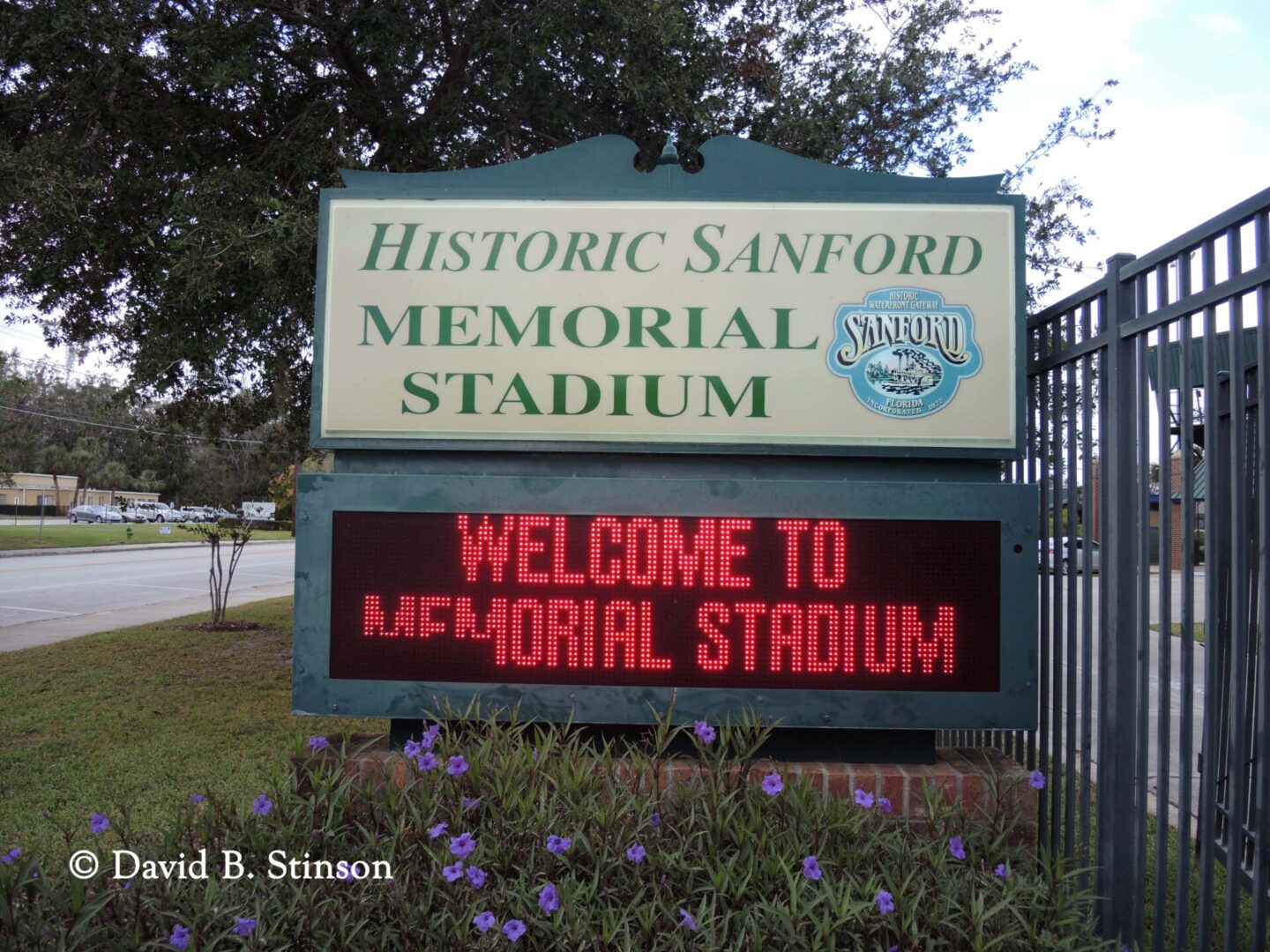
Sanford Field, Historic Sanford Memorial Stadium, and Sanford Museum
By Byron Bennett |
Historic Sanford Memorial Stadium is located at 1201 S. Mellonville Avenue in Sanford, Florida. Entrance ...
Read More 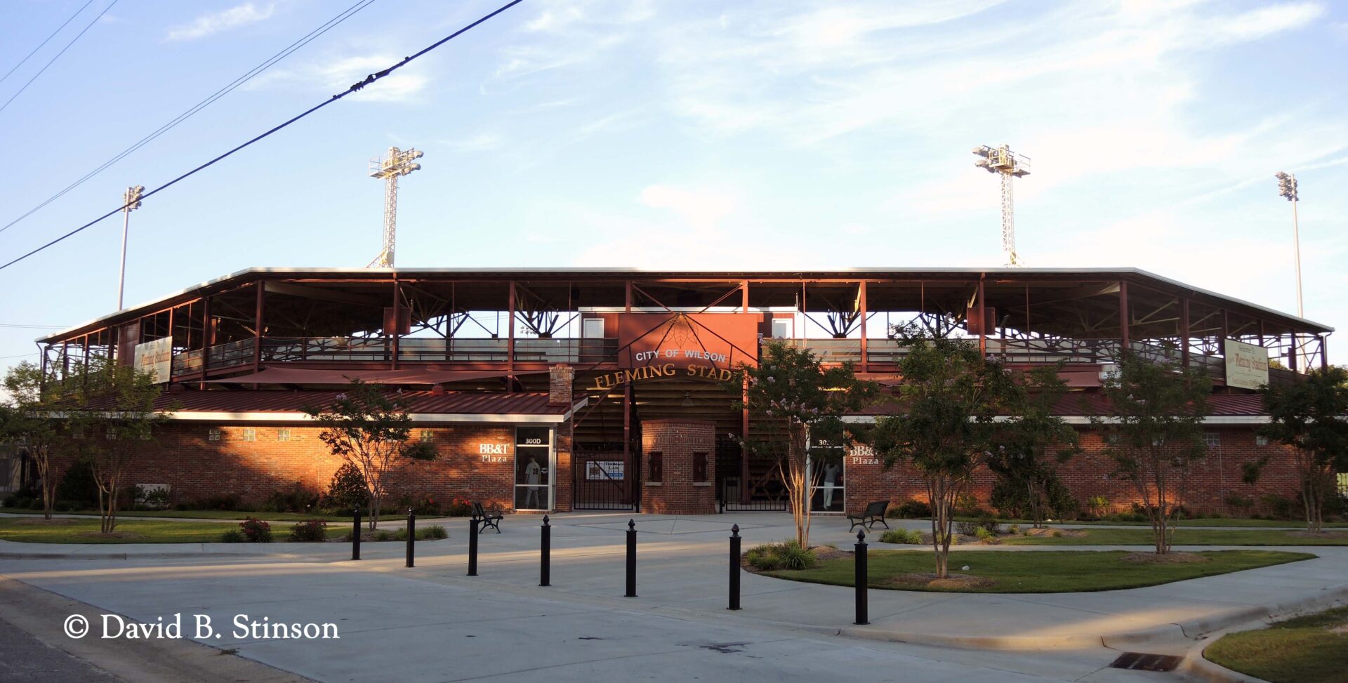
Fleming Stadium and the North Carolina Baseball Museum
By Byron Bennett |
Fleming Stadium, Wilson, North Carolina It also houses the North Carolina Baseball Museum, located on ...
Read More 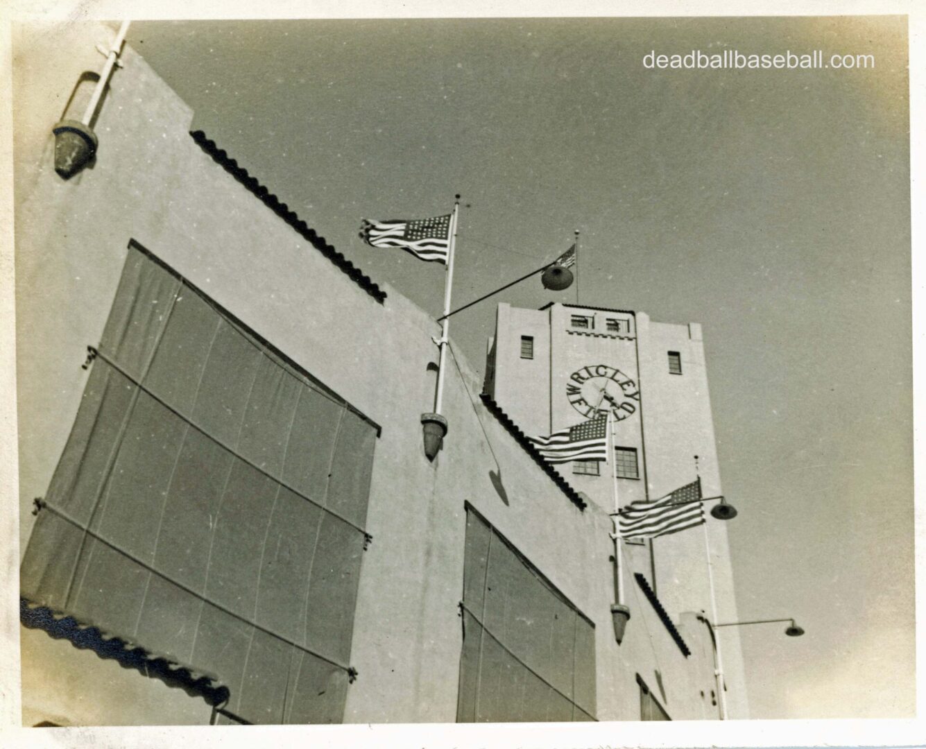
The West Coast Wrigley Field
By Byron Bennett |
Wrigley Field was located at 425 East 42nd Place, in Los Angeles, California, on the ...
Read More 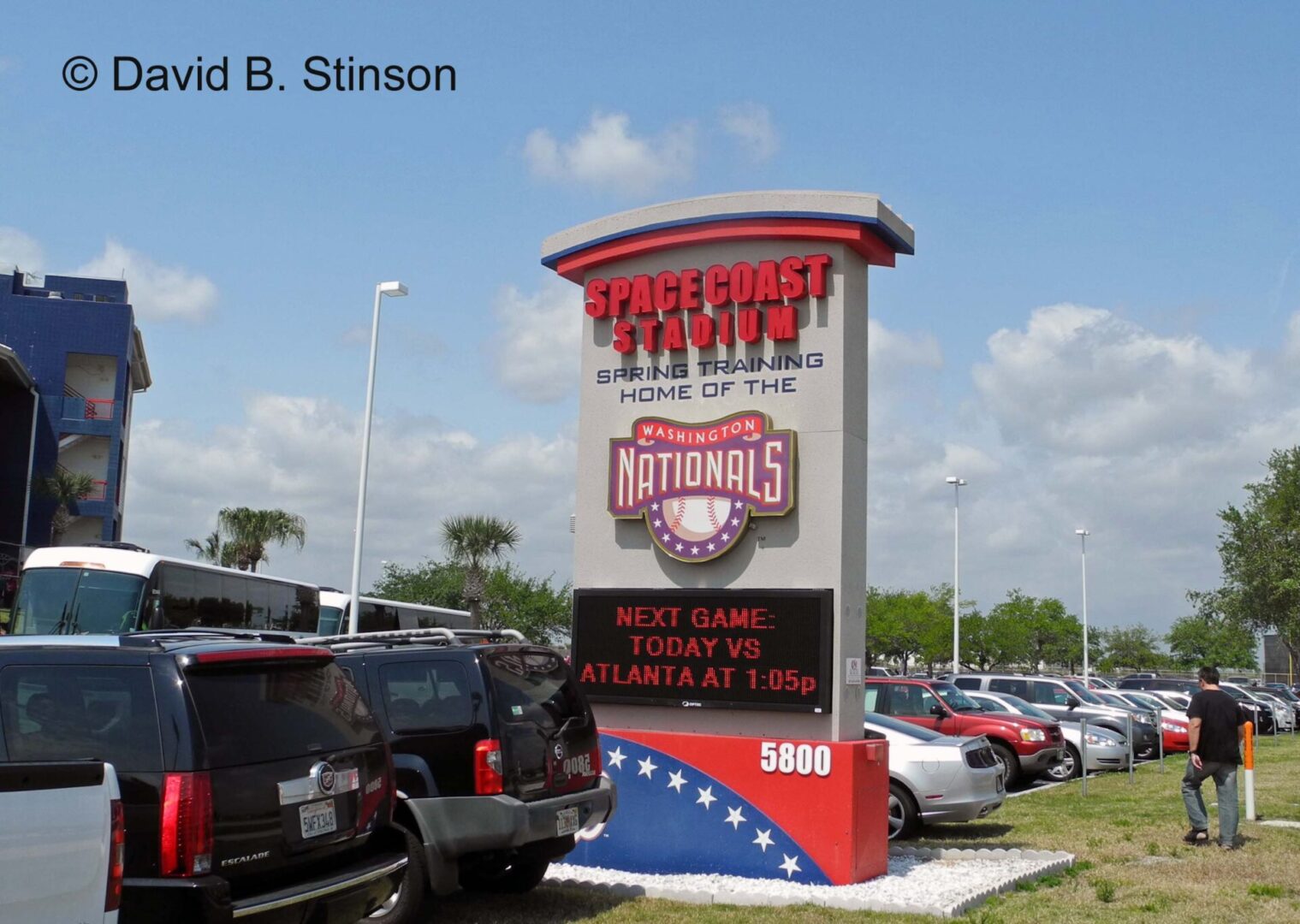
Space Coast Stadium’s New Frontier
By Byron Bennett |
Space Coast Stadium (now Space Coast Complex) is located at 5800 Stadium Parkway in Viera, ...
Read More 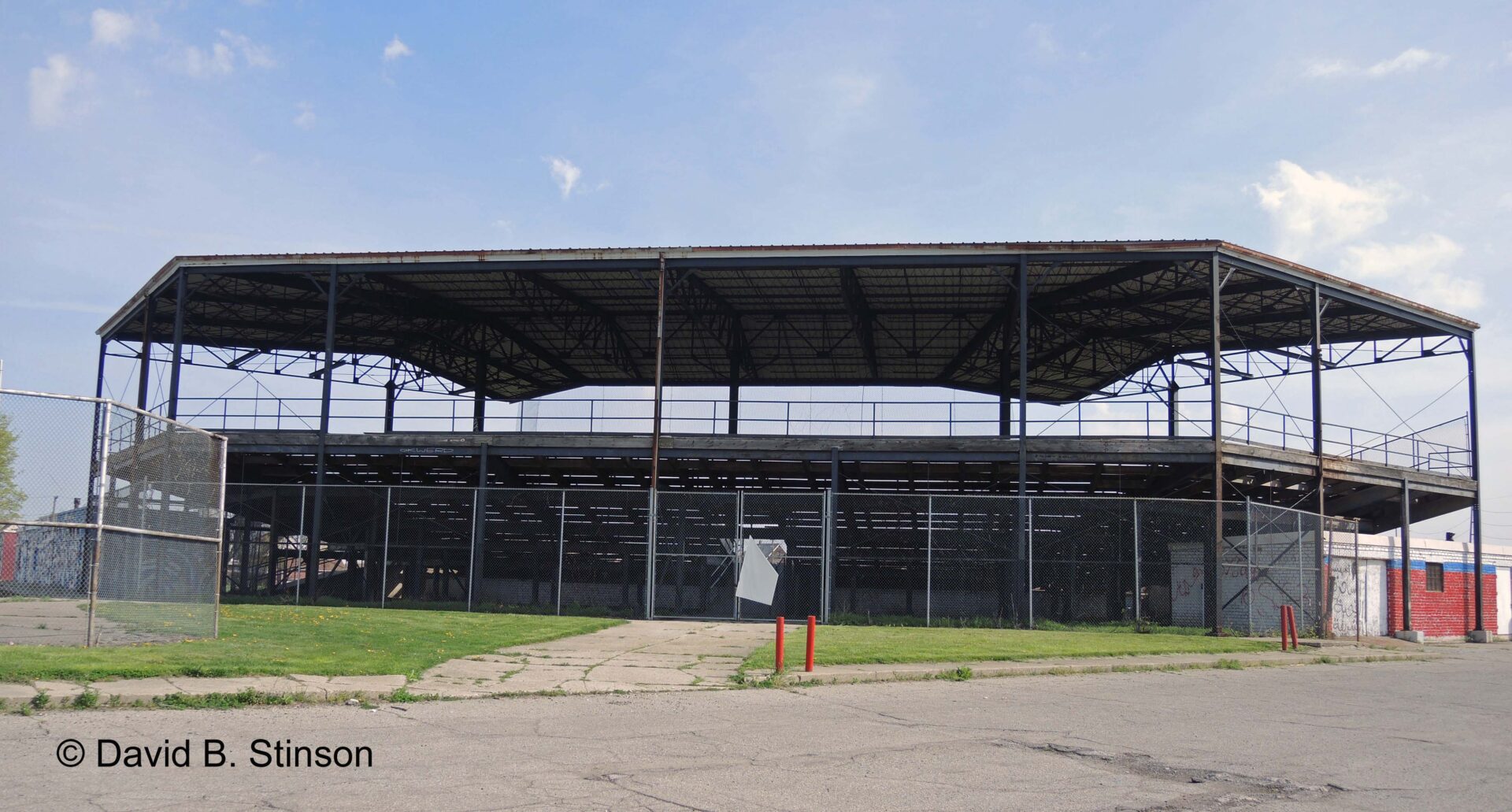
Hamtramck Stadium – Detroit’s Diamond in the Rough
By Byron Bennett |
Hamtramck Stadium is located at 3201 Dan Street in Hamtramck, Michigan, one block east of Joseph ...
Read More 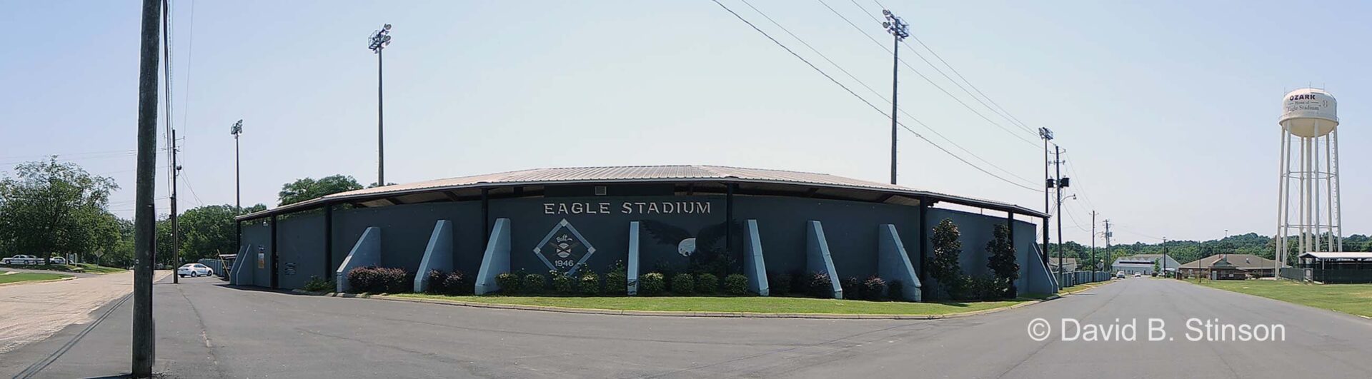
Eagle Stadium Still Soaring In Ozark, Alabama
By Byron Bennett |
Eagle Stadium is located at 698 Martin Street in Ozark, Alabama. Eagle Stadium in Ozark, ...
Read More 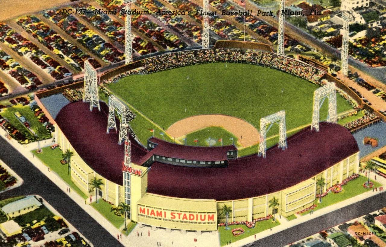
Miami Stadium – Later Bobby Maduro Stadium
By Byron Bennett |
Miami Stadium was located at 2301 Northwest 10th Avenue in Miami, Florida. Miami Stadium Postcard (Gulf ...
Read More 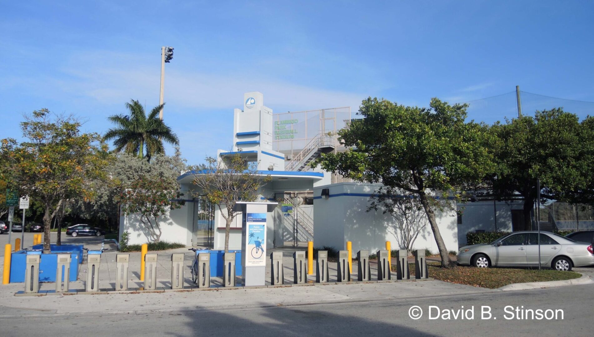
Flamingo Field in Miami Beach, Florida
By Byron Bennett |
Flamingo Park Baseball Stadium is located at 15th St and North Michigan Avenue in Miami ...
Read More 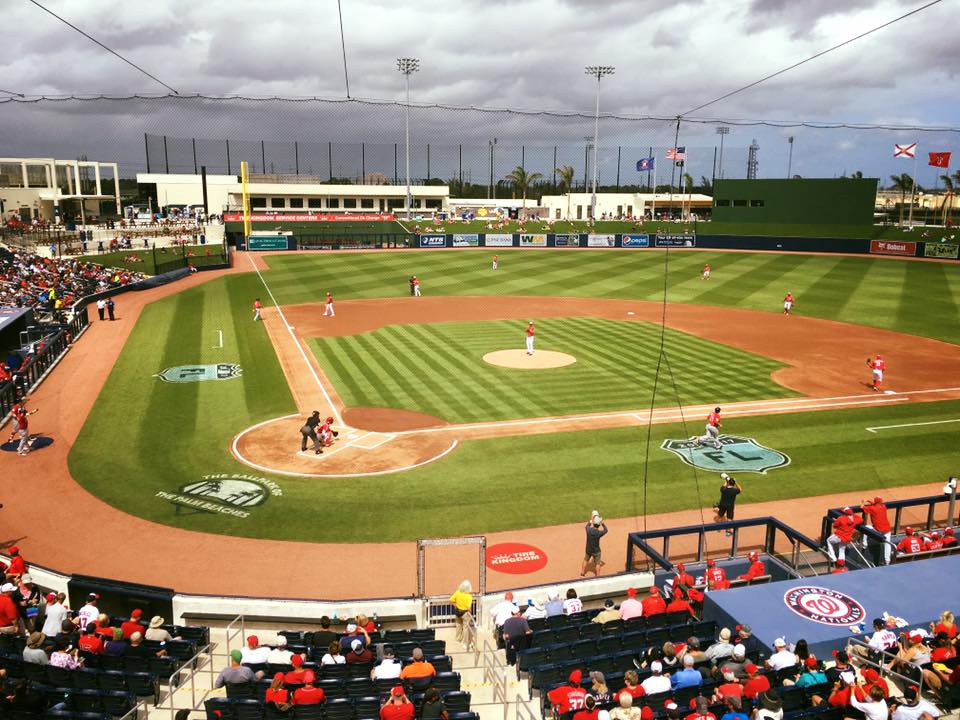
West Palm Beach Spring Training History – Connie Mack Field and Municipal Stadium
By Byron Bennett |
West Palm Beach boasts a proud Spring Training history. Both the Houston Astros and the ...
Read More 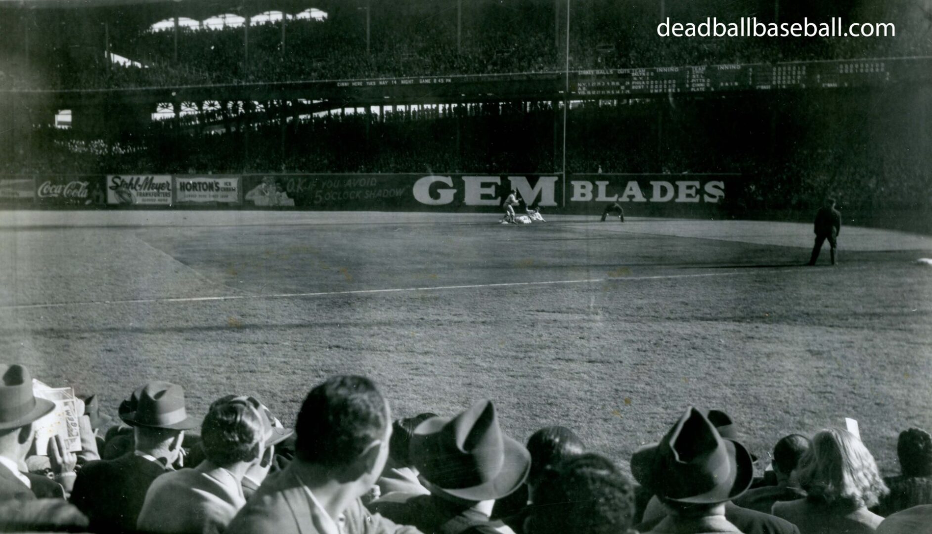
The Polo Grounds and the Autonomy of a Baseball Snapshot
By Byron Bennett |
A baseball snapshot is a souvenir of a day at the ballpark. Taken not by ...
Read More 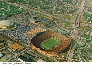
Jacksonville’s Wolfson Park Now the NFL Jaguars’ Practice Field
By Byron Bennett |
Jacksonville Baseball Park was located at 1201 East Duval Street in Jacksonville, Florida, just northwest ...
Read More