
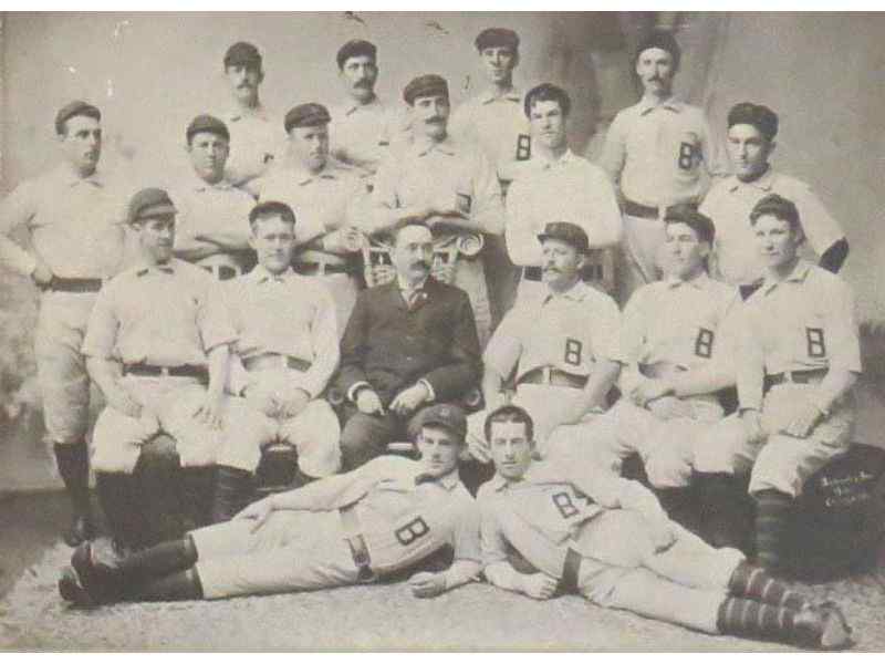
Union Park lasted as a major league venue for a mere nine seasons, from 1891 to 1899. Known also as Oriole Park (III) and the Baltimore Baseball and Exhibition Grounds, the ballpark was home of the World Champion (1894-1896) National League Baltimore Orioles. Union Park was located at the corner of East 25th Street and and what is now Hunter Street in the Barclay section of Baltimore, just south of Harwood.
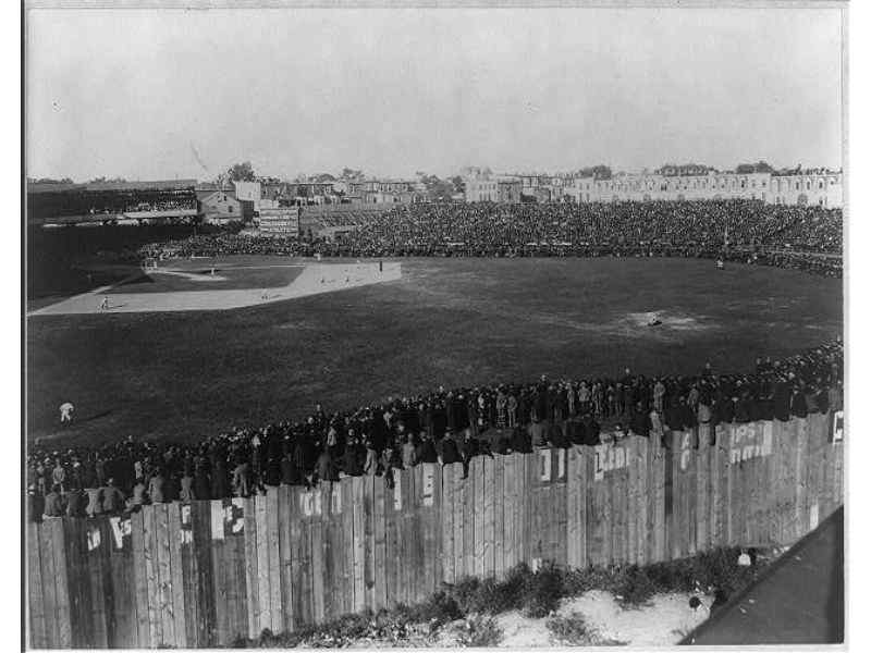
In the picture above, the houses immediately to the right of the grandstand are located on East 25th Street. The houses on the right side of the picture, looming behind left center field, are located on Barclay Street.
Many of those houses remain at the site today, providing a point of reference for the ball field.
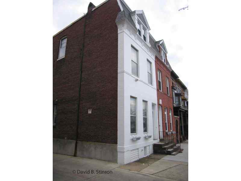
The back side of the building located at 321 East 25th Street, which currently houses the St. Ambrose Housing Aid Center, with its distinctive pitched roof, can seen in the 1897 photograph, immediately to the right of the grandstand.
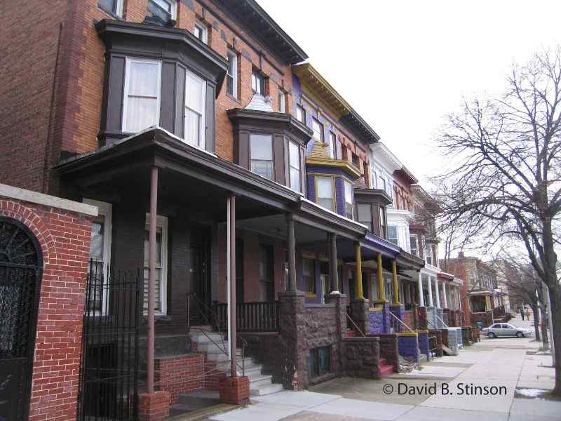
The houses on the east side of Barclay Street are visible in the 1897 photograph of Union Park, just behind the bleachers in left field.
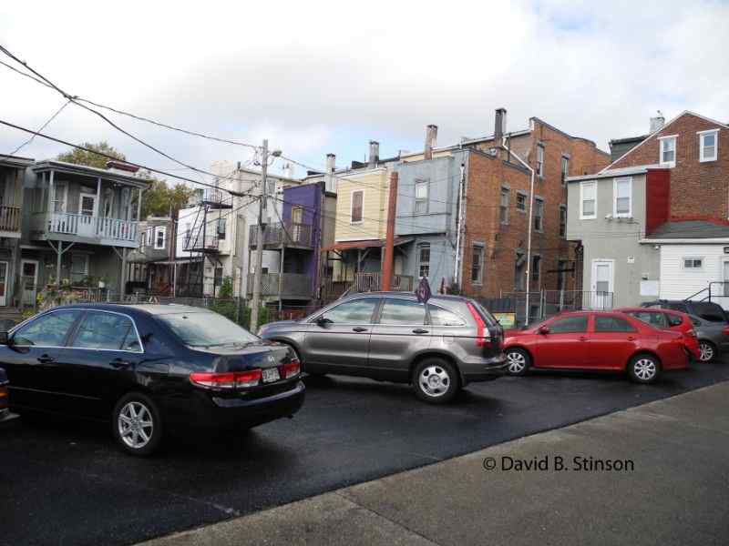
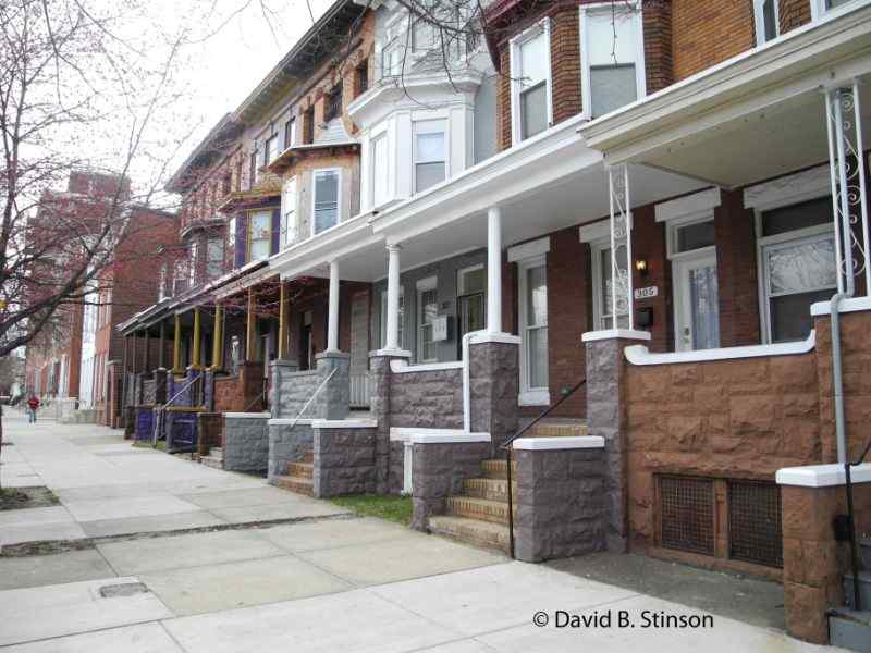
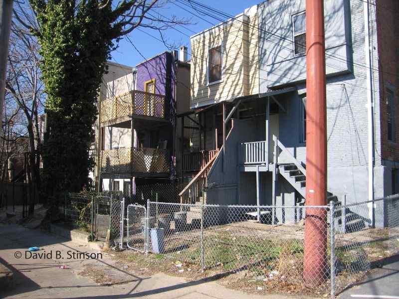
In the above photograph – the corner of East 25th Street and Barclay – the house to the left was built on what would have once been Union Park’s center field.
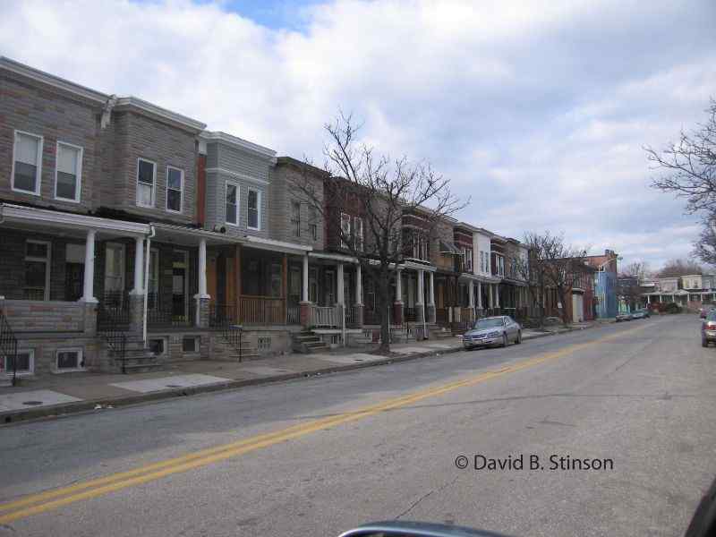
The houses on the west side of Barclay Street, looking toward East 25th Street, pictured above, sit in place of Union Park’s left and center field bleachers.
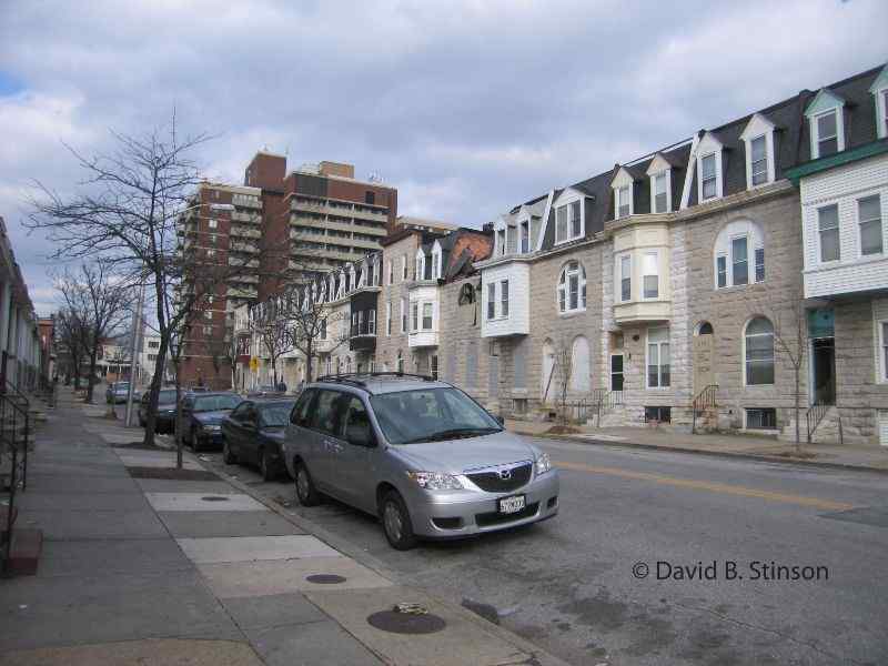
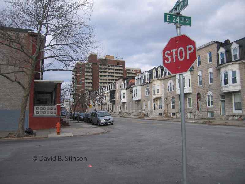
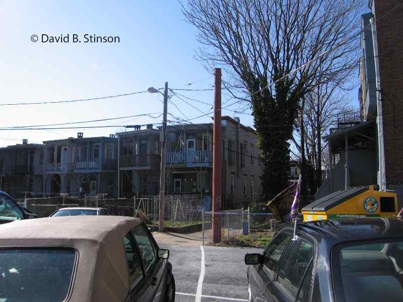
Union Park’s right field was located at the corner of East 24th Street and Guilford Avenue, which is seen in the above photograph, looking on East 24th Street toward Guilford. The brick buildings to the right of the picture along East 24th Street were constructed after the demolition of Union Park. Indeed, the buildings that line East 24th Street today sit in the southern most point of Union Park’s outfield.
A Sanford Insurance Map from 1901 shows the exact location of Union Park.
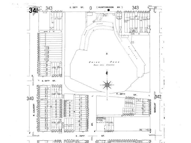
According to the Sanborn map it appears that Guilford Avenue originally dead ended at 24th Street and that a portion of the first base grand stand actually sat in the middle of what is now Guilford Avenue.
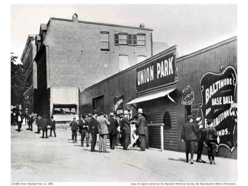
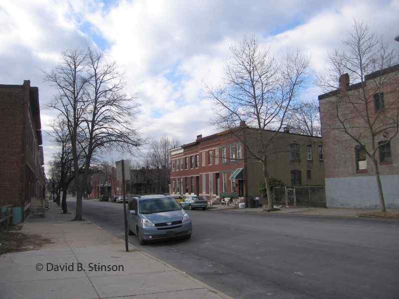
The above photograph shows the entrance to Union Park on East 25th Street. The brick building in the background, beyond the wooden ballpark, remains today at the site. It is the same building mentioned above that was located just to the right of the Union Park grandstand, and sits at 321 East 25th Street.
The red brick building at 321 East 25th Street is visible in the background of the above photograph. To the right of that building is Falls Alley, which allows entrance into the former playing field from East 25th Street.
The row houses contructed on the site of Union Park’s former grandstand date to the early 1920s.
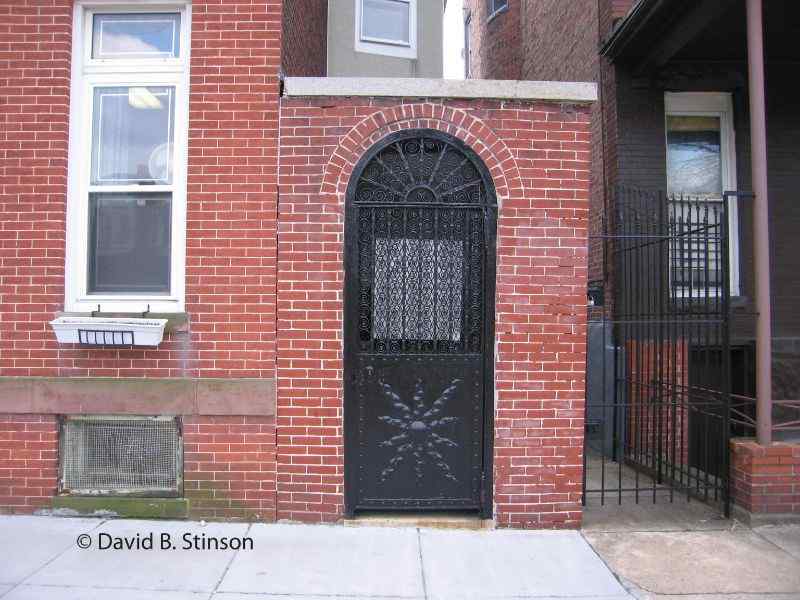
Still remaining at the former site of Union Park is a short red brick wall with an iron gate entrance that once stood next to the Union Park grandstand. Behind that gate was once a soda stand. That soda stand can be seen above in the 1895 photograph of Union Park, next to 321 East 25th Street.
It is estimated that home plate sat behind the row house that currently sits at 303 East 25th Street.
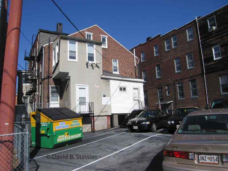
The area that was once the infield is now a parking lot and a collection of brick garages – an unceremonious use of such hallowed ground.
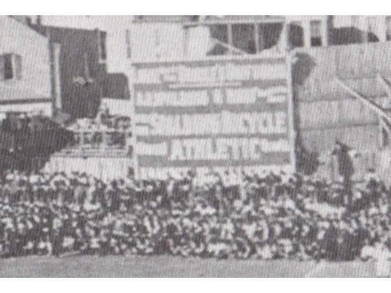
Just to the right of the house at 321 East 25th Street, along the left field foul line, was a large, two-story billboard for “A.G. Spalding & Bros.” The billboard advertised Spalding bicycles and athletic equipment.
Although Union Park was wiped from the landscape over 100 years ago, the neighborhood surrounding the former site offers several clues to the ballpark’s location. It certainly is worth a trip for any fans of the Baltimore Orioles.
With the demolition 10 years ago of Memorial Stadium, there currently exists no baseball venue in Baltimore where the Orioles have won a World Championship.
For more baseball history located nearby, see John McGraw and St. Ann’s Catholic Church for pictures and information about where Orioles third baseman John McGraw married his second wife, Blanche Sindall. For pictures and information about American League Park – located just four blocks north Union Park and where McGraw played and managed the 1901-02 American League Baltimore Orioles, see The Orioles First American League Park. To see where McGraw and three of his Hall of Fame teammates are buried just a few miles west, see New Cathedral Cemetery, Final Resting Place of Four Oriole HOFs.