
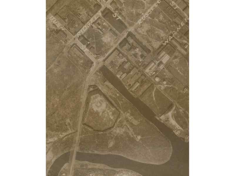
One of the more significant “unknowns” concerning Baltimore’ s lost ballparks has been the exact, former location of Maryland Baseball Park, which from 1921 to 1932 was the home ballpark of the Baltimore Black Sox. Newspaper accounts of the ballpark’s location offer little more than the ballpark’s general location at the intersection of Bush Street and Russell Street, near the Ridgely street car line. Because there is no known photographs of the ballpark, its actual location at the intersection of Bush and Russell remained a mystery.
Bernard McKenna, a professor at the University of Delaware, was convinced there had to be a photograph of the ballpark somewhere. His research led him to a website maintained by Johns Hopkins University. In 1927 the Maryland Port Administration arranged for aerial photographs to be taken of Baltimore, Maryland. Additional aerial photographs were taken in 1937. In 2011, Johns Hopkins University digitized these photographs and made them available on line.
Hidden in plain site within those aerial photographs were several of Baltimore’s Lost Ballparks, including the previously elusive Maryland Baseball Park. Below is a rundown of the photographs Mr. McKenna uncovered (as well as one provided by Larry Jendras, Jr.). Just click on the picture for a more detailed view of the image. Click on the ballpark name for more information about the various lost ballparks.
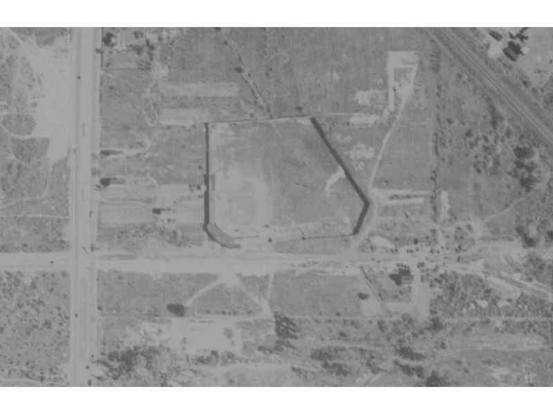
Maryland Baseball Park (also known as Maryland Park), home of the Baltimore Black Sox from 1921 to 1932, was located at the intersection of Bush and Russell Street on what is now 1801 Annapolis Road. Wheelabrator, a sold waste incinerator facility, now occupies the former site of Maryland Baseball Park.
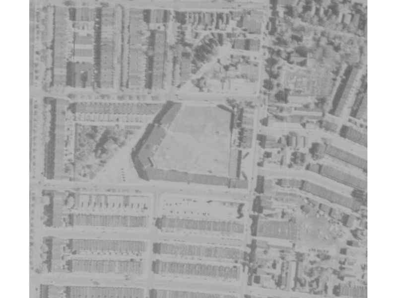
Bugle Field, home of the Baltimore Elite Giants from 1938 to 1949, was located at the the southwest corner Federal Street and Edison Highway. The Rockland Industries Building now sits in the footprint of the original grandstand.
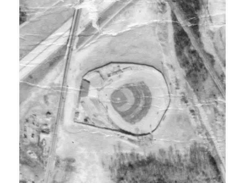
Westport Stadium, home of the 1950 Baltimore Elite Giants, was located on a triangular shaped piece of property north of the intersection of Patapsco Avenue and Annapolis Road and just south of the Baltimore Washington Parkway (I-295). The site is now a vacant lot just north of Patapsco Arena. This aerial photograph, a USGS image, was provided courtesy of Larry Jendras, Jr.
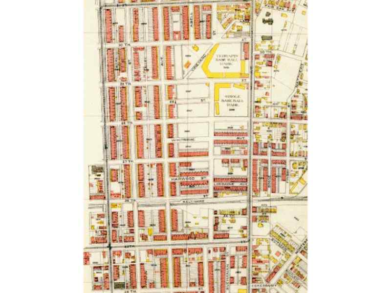
Terrapin Park (later known as Oriole Park), located at the northwest corner of 29th Street and Greenmount Avenue, was home to the Federal League Baltimore Terrapins in 1914 and 1915, the International League Orioles from 1916 to 1944, and the Baltimore Elite Giants from 1938 to 1944. The Barclay School and the former E.I. duPont de Nemours & Co. Inc. Finishes Division, sit in the former location of the ballpark’s grandstand.
Terrapin Park was located directly across East 29th Street from American League Park, which was located at southwest corner of 29th and Greenmount. American League Park (also known as Oriole Park) was the former home ballpark of the 1901-02 American League Baltimore Orioles and the 1903-1914 International League Baltimore Orioles. The location of that ballpark is shown in the map below. American League Park was the home field where Babe Ruth played for the International League Orioles during his one season of professional baseball in Baltimore.
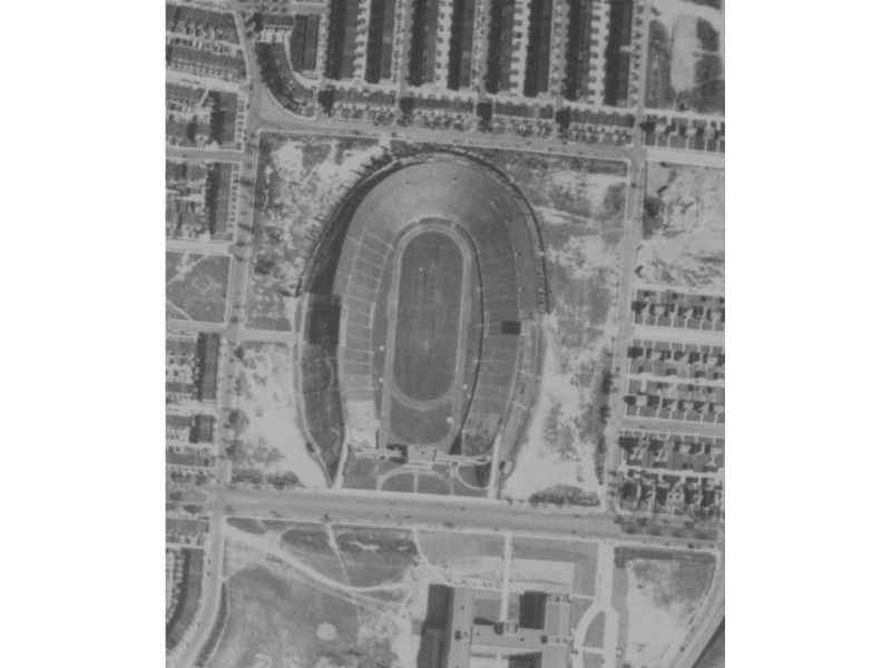
Memorial Stadium, located at the northeast corner of Elerslie Avenue and 33rd Street, was built on the site of an earlier stadium constructed in 1922, known as Baltimore Stadium, Venable Stadium, and Municipal Stadium. Shown in the photograph below is Municipal Stadium, a large earthen ballpark that hosted college football as well as the International League Baltimore Orioles from 1944 to 1953.
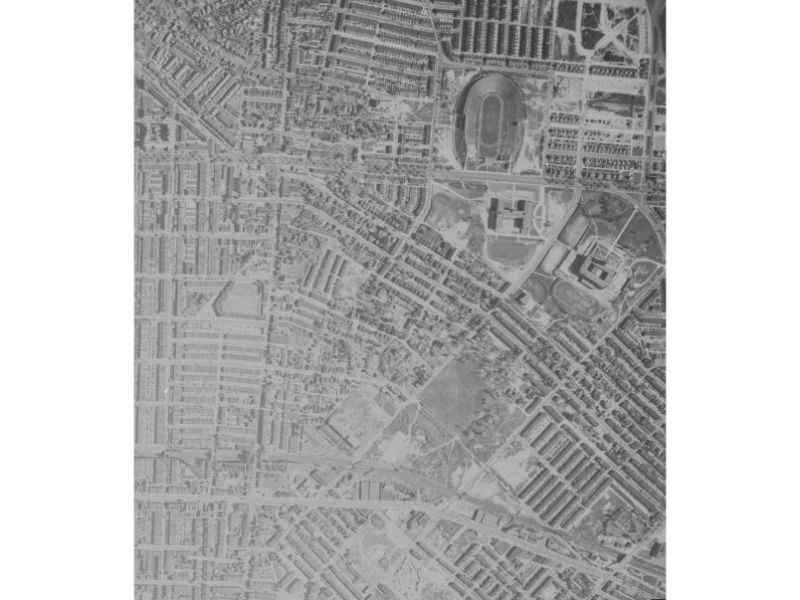
The 1937 aerial photograph reproduced below shows both Terrapin Park/Oriole Park and Municipal Stadium, located less than one mile apart. Also included in that aerial shot is the former site of American League Park, located one block south of Terrapin Park/Oriole Park, and the former site of Union Park, located four blocks south of Terrapin Park/Oriole Park at the intersection of 25th Street and Guilford Avenue. Union Park was the home to the 1890’s world champion National League Baltimore Orioles.
Although all these ballparks are now lost to time, the Maryland Port Administration’s incredible photographs help the ballparks’ live on. Many thanks to Johns Hopkins University for putting these photographs on line, and thanks to Mr. McKenna for having found the images of the ballparks hidden within.