
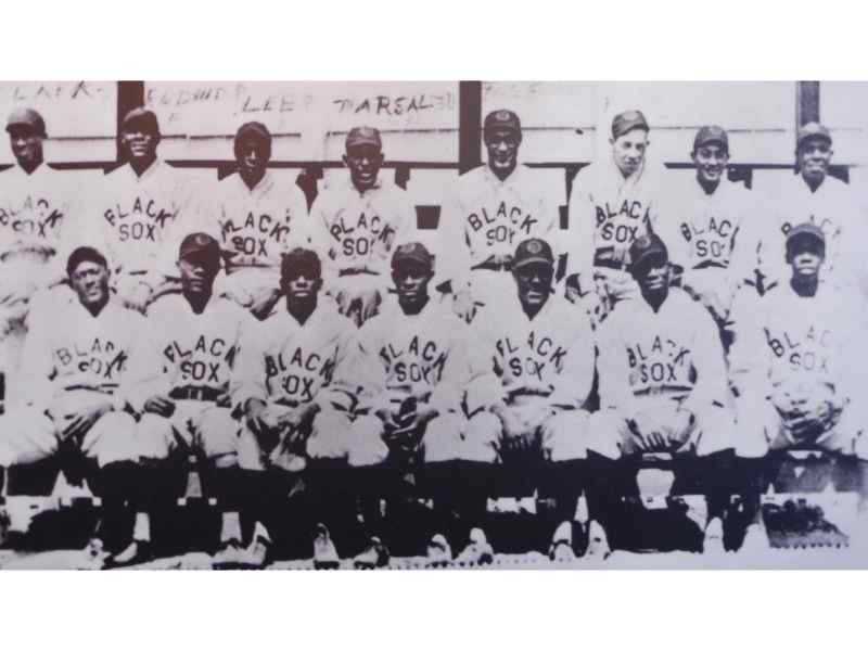
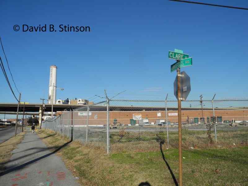
Just south of Camden Yards are two historic baseball sites, the exact location of which was unknown until November 2013. The first was Maryland Baseball Park, located at the intersection of Bush Street and Russell Street, where the Baltimore Black Sox played from 1921 to 1932. The second was Westport Park, located two blocks south of Maryland Baseball Park at the intersection of Clare Street and Annapolis Road. Westport Park is where the Baltimore Black Sox played their home games from 1917-1920. (Note: there was a second Negro League ballpark in Baltimore known as Westport Stadium, located two miles south on Annapolis Road between the Baltimore-Washington Parkway and Patapsco Avenue, where the Baltimore Elite Giants played in 1950).
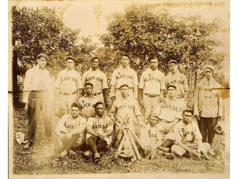
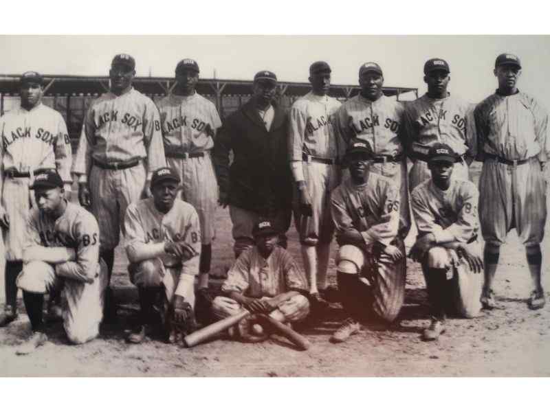
The Baltimore Black Sox began about 1913 as an independent team and in 1923 joined the Eastern Colored League. In 1929 they were associated with the American Negro League and from 1930-1931 they were once again an independent team.
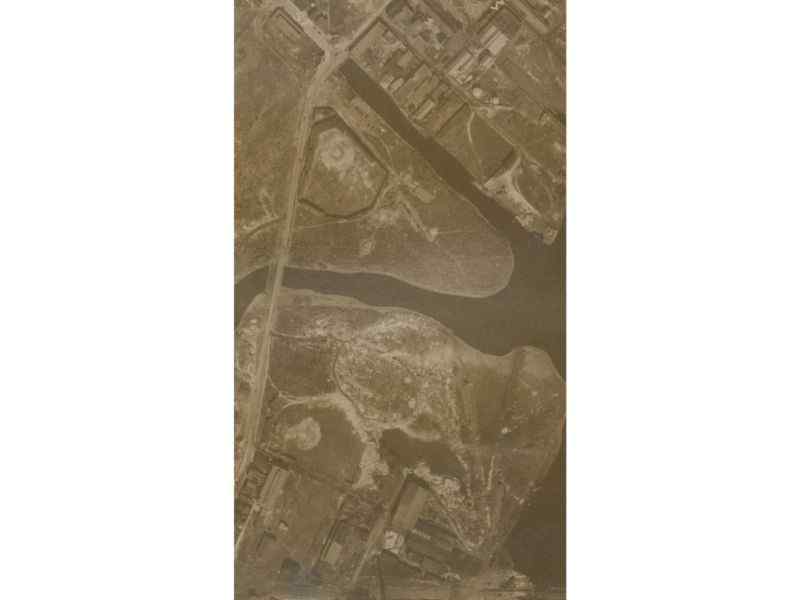
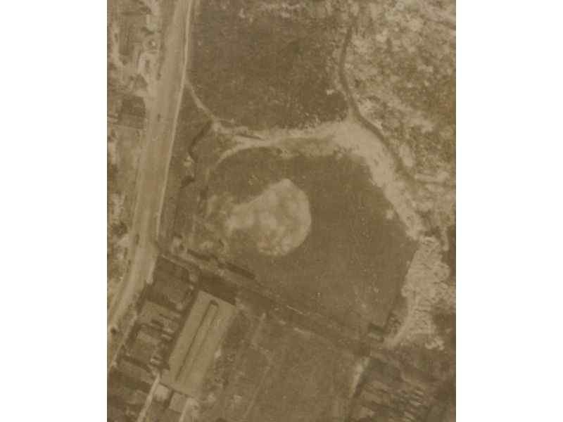
Bernard McKenna, a Baltimore baseball fan and ballpark historian, discovered an aerial photograph taken by the Maryland Port Administration (and digitized by Johns Hopkins University) showing the exact location of the Maryland Baseball Park. Up until Mr. McKenna’s discovery in November 2013, the exact location of Maryland Baseball Park was unknown, as there were no known photographs of the actual ballpark.
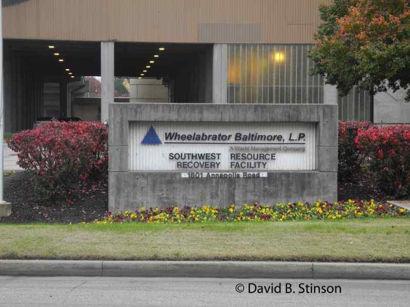
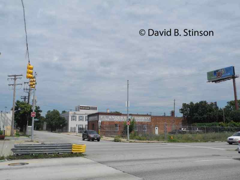
Maryland Baseball Park was located at the intersection of Bush and Russell Street on what is now 1801 Annapolis Road.
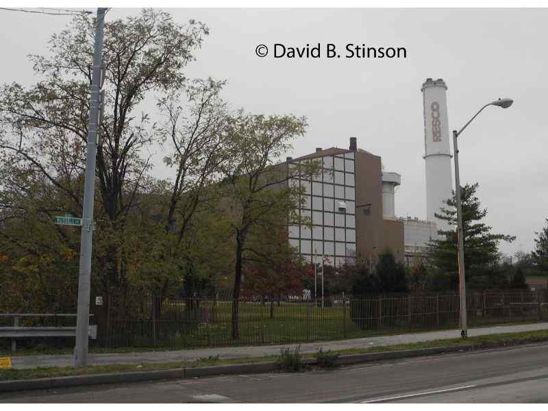
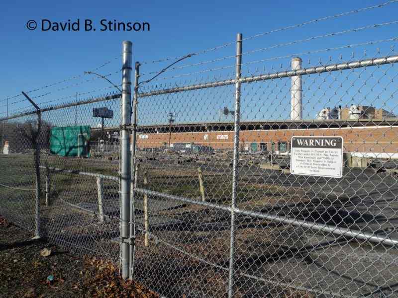
Wheelabrator, a sold waste incinerator facility, now occupies the former site of Maryland Baseball Park.
The site is bounded to the northeast by Gwynn Falls Stream, which can be seen in the picture below as well as the 1927 aerial photograph of Maryland Baseball Park.
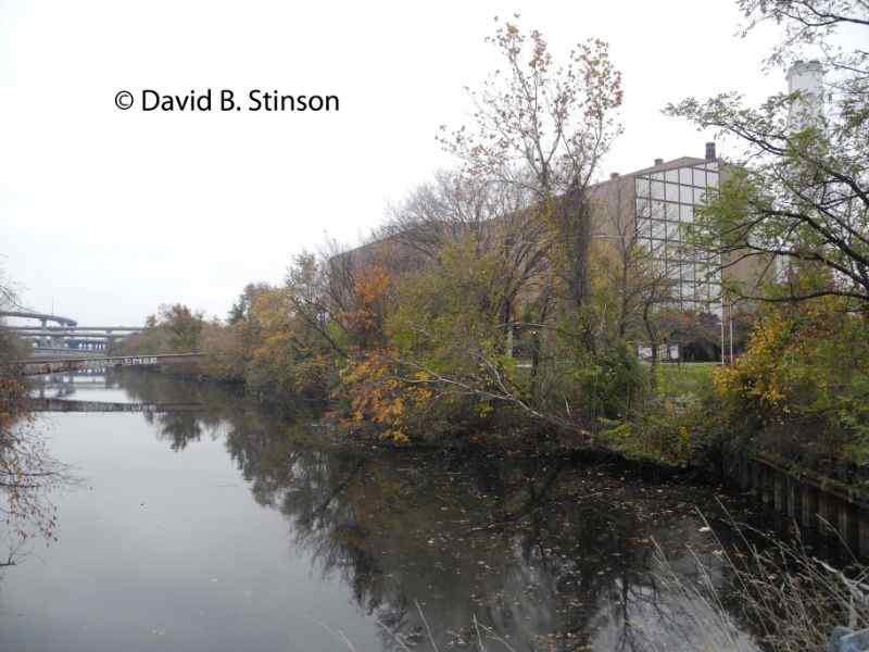
Maryland Baseball Park’s former left field foul line ran parallel to Gwynn Falls Stream.
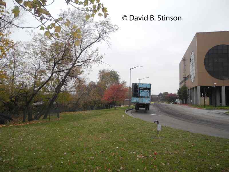
Maryland Baseball Park’s former right field foul line ran parallel to Annapolis Road.
Maryland Baseball Park’s former grandstand and infield once sat in the spot now occupied by the front entrance to the Wheelabrator facility.
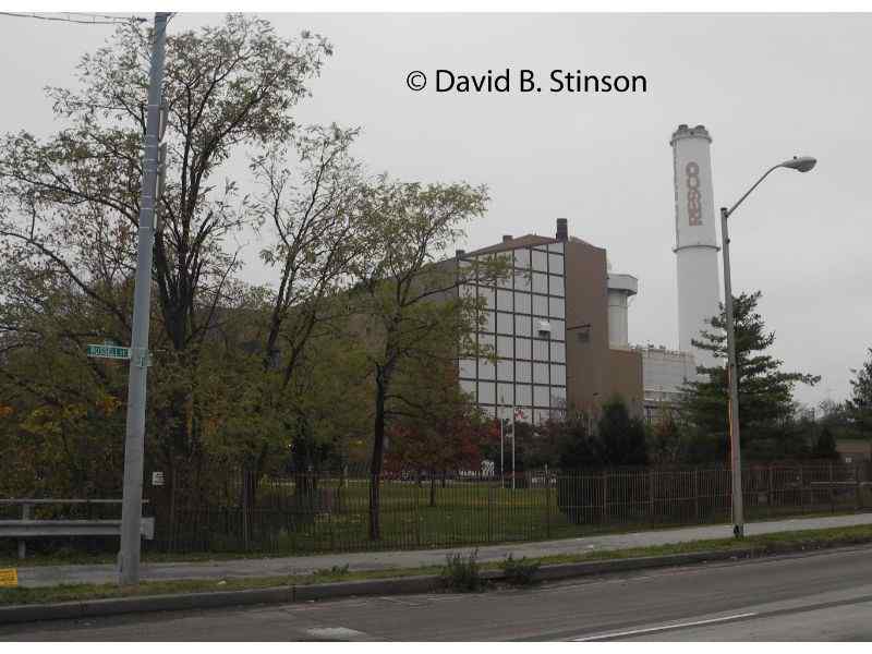
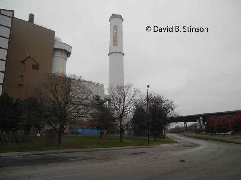
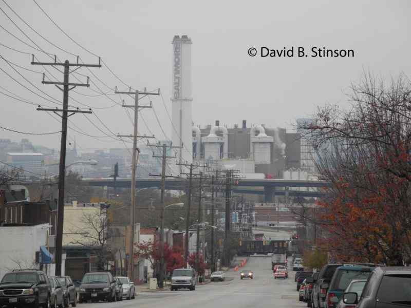
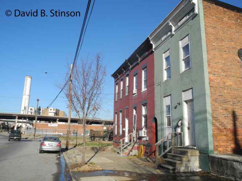
The distinctive smoke stack, with the words “Baltimore” and “RESCO” painted on its sides, dominates the site, providing an easy landmark for anyone trying to find the former site of Maryland Baseball Park.
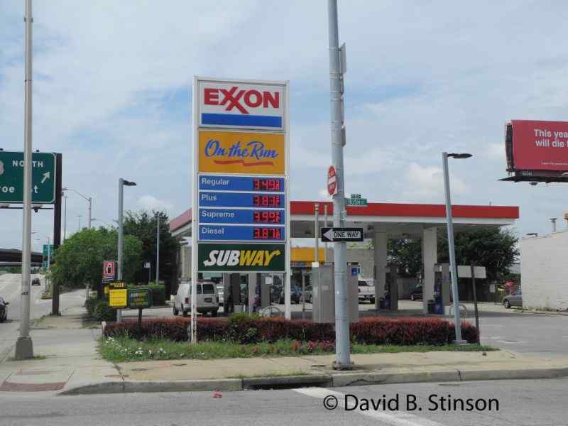
On the southwest corner of Russell and Bush Street is an Exxon gas station at 1800 Russell Street, which is located across the street from the former site of Maryland Park.
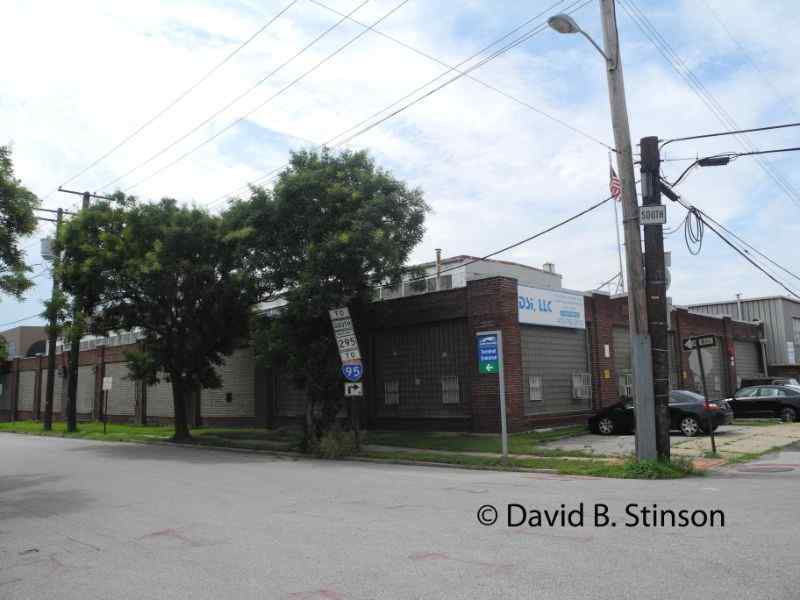
Behind the Exxon at 1701 Ridgely Street is a warehouse, which, according to city land records, was constructed n 1925. The building is the current home of DSI,LLC, a company that sells mechanical equipment. That building can be seen in the 1927 aerial photograph of Maryland Baseball Park.
Several other buildings that date to the time of Maryland Baseball Park remain across Russell Street, catty-corner from the ballpark site. At 1925 Bush Street is the F.L. Anderson Company, built in 1914. According to Charles Underwood, Vice President of F.L. Anderson, land in that area was constructed on top of infill material from the great Baltimore fire of 1904. The building at 1645 Ridgely Street, located just northwest of F.L. Anderson, likewise dates to the early 1900s.
The land on which Maryland Baseball Park was constructed was owned by the B&O Railroad. Newspaper advertisements of the day tout the ballpark’s easy access on the “Ridgeley Car Line.” Ridgeley Street is located northwest of the former ballpark site and can be seen in the 1927 photograph of Maryland Baseball Park.
The Black Sox were the ballpark’s major tenant. However, other sporting events, such as boxing and soccer, were played at the park. Notable games played at Maryland Baseball Park include games three and four of the 1924 Negro League World Series between the Hilldales and the Kansas City Monarchs.
As to the location of the Black Sox’s earlier ballpark, evidence uncovered by Mr. McKenna likewise suggests that Westport Park was located two blocks south of Maryland Baseball Park at the intersection of Clare Street and Annapolis Road.

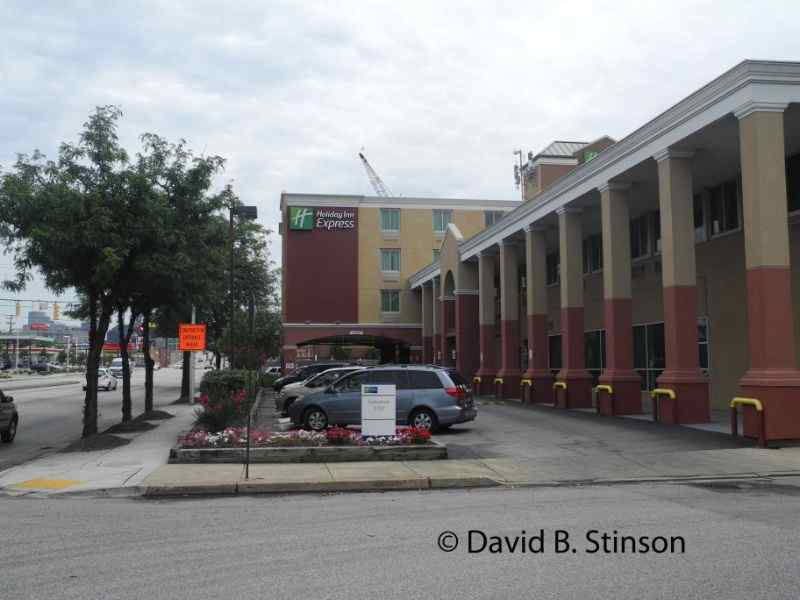
Previously, it had been thought that Westport Park was located north of the intersection of Russell and Bush Streets. According to James Bready’s book “Baseball in Baltimore,” Westport Park was located at 1701 Russell Street. A Holiday Inn Express now sits at that site. At the northeast corner of Bush and Russell Streets today is a BP Gas Station which sits directly south of the Holiday Inn. In actuality, Westport Park was located south of Maryland Baseball Park.
Because there was no known picture of Westport Park, it was difficult to determine precisely where the ballpark actually sat. The same aerial photograph taken by the Maryland Port Administration, which shows the location of Maryland Baseball Park, also shows what remained at that time of Westport Park.
Home plate was near the northeast corner Claire Street and Annapolis Road.
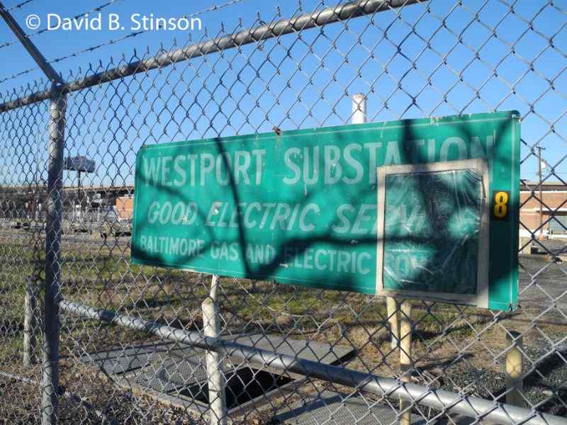
Up until recently, the portion of the site that was once the first base side of the ballpark was occupied by the Westport Electrical Substation.
The land is owned by the Baltimore Gas and Electric Company and it is uncertain whether anything is planned for the site. Perhaps a neighborhood ballfield?
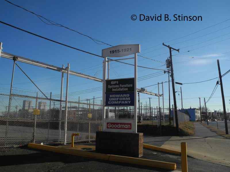
The shopping center at 1915 – 1921 Annapolis Road sits on what was once Westport Park’s left field corner.
Houses that date to to the time of Westport Park are located just south of the site on Annapolis Road. The house at 2009 Annapolis Road was built in 1920, while the houses at 2011 and 2013 were built in 1900.
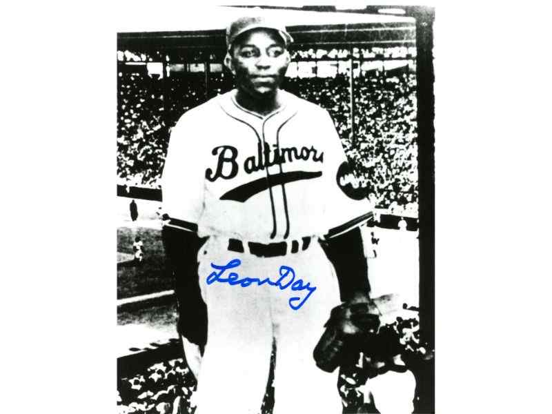
In 1932 the Black Sox joined the East West League and played their games at Bugle Field, home of the Baltimore Elite Giants. Bugle Field was located at the intersection of Federal Street and Edison Highway. In 1933-1934 the Black Sox were members of the Negro National League. Future Hall of Famer Leon Day, a Baltimore native, began his professional career with the 1934 Black Sox. According to Robert Leffler’s thesis “The History of Black Baseball in Baltimore 1913 to 1951,” Maryland Baseball Park became a junk yard in 1934.
The Elites left Bugle Field after the 1949 season and played their home games at Westport Stadium in 1950 (not to be confused with Westport Park). Once located on Old Annapolis Road between Route 295 (Baltimore-Washington Parkway) and Patapsco Avenue, Westport Stadium subsequently was used as a NASCAR-sanctioned racetrack.
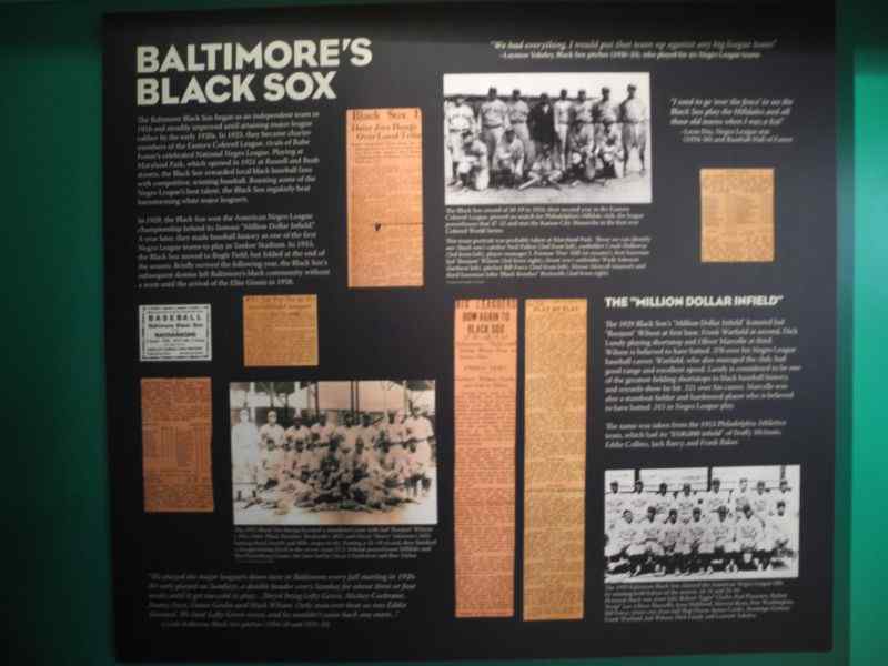
The Sports Legends Museum, located next to Orioles Park at Camden Yards a mile northeast of the old site of Maryland Baseball Park, includes a tribute to the Black Sox.
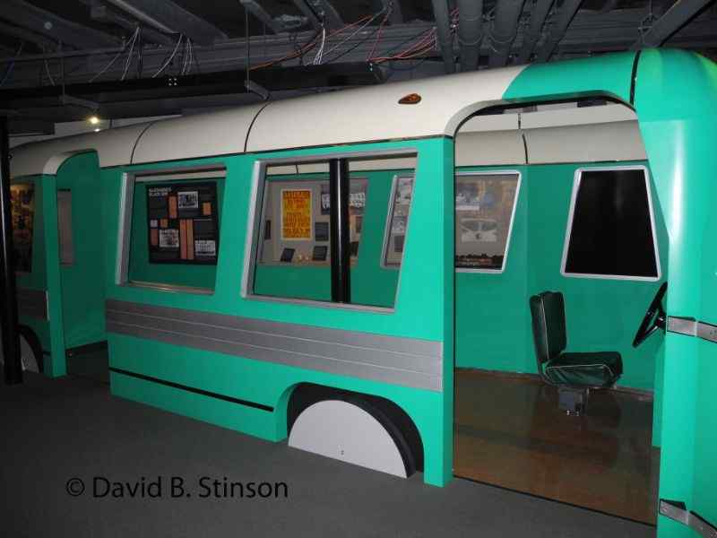
A bus similar to the type that Negro League players once road is included in the Sports Legends Museum display.
Westport Park and Maryland Baseball Park are both truly lost ballparks. Now, thanks to Mr. McKenna, we have photographs and know the exact location of each park. Both sites are worth a visit the next time you find yourself heading to or from an Orioles game at Camden Yards.